COLORADO URBAN FIRES WERE NOT AN ACT OF GOD.
Land Alterations Cause Weather Pattern Changes. The chinook winds would not spur fire damages in a healthy watershed. This article continues my recent blog explaining the cause of amplified chinook wind destruction, which manifested at the foothills of the Rocky Mountains in Colorado and caused the Marshall and Middle Fork fires in Boulder county. Thus, I took a virtual walk with Google map street view and looked at the region to examine some context and the root of the problem.
The cause of this climate phenomenon, which occurs mainly in autumn and winter, is the rapid cooling of the dry part of the countryside and the temperature gradient between the still-warmed landscape and adjacent cold areas, causing extreme winds aloft from the mountains to the valleys. The force of the wind accelerates in those regions of the world where a particular part of the country cools suddenly, and the adjoining portion of the country remains warm. The boundaries between mountain ranges and plains create the prime conditions for these weather extremes. As the wave of air flows up and over the mountain, it accelerates the force of the wind. Inversion multiplies the speed. At the same time, the adjacent and still-warm landscape provides perfect conditions for the extreme winds from the mountains to the valleys. One such area is in the foothills of the Rocky Mountains, next to the vast dried-up prairie in Colorado. We call these winds “bora” in Slovakia or “foehn” in Germany. The latest severe bora caused significant havoc in 2004 at the foothills of the 2,500 m (8,200 ft) peaks of the Tatra mountains, uprooting monoculture spruce trees for tens of thousand acres of land.
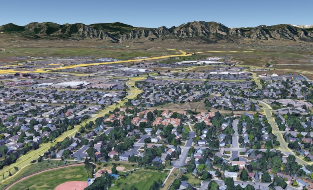
Colorado is home to 5.8 million residents, many of whom live in the cities sprawling within fifteen miles of the foothills of the Rocky Mountains, from north to south. Almost 90% of the citizens live close to the mountains. These towns originated at the times of the Gold Rush and gradually transformed into new modern cities, which adapted their infrastructure to current traffic and business demands that provide for people nowadays.
Denver urban policy goes in line with the rest of the world: to provide comfort and dry dwellings and road conditions to the people who live there. Modern urban policies are designed for rainwater drainage as fast as possible. Google maps street view allowed me to view the regulated waterways, such as the creek in Denver. Albeit virtually, I visited Denver and the towns of Superior and Louisville, which lost more than one thousand homes in the Marshall fire, December 30, 2021. Almost 35 thousand people had to be evacuated within hours due to imminent fire risk during the high wind reaching gusts of 110 miles per hour. Unfortunately, at the time of writing this article, three people are still missing.
Recent studies by the U.S. Geological Survey and other scientists suggest that the region may become drier for 2 to 3 decades. Annual precipitation in this area is less than 400 mm. Nevertheless, the urban areas allow for rainwater drainage, amounting to large quantities of water loss.
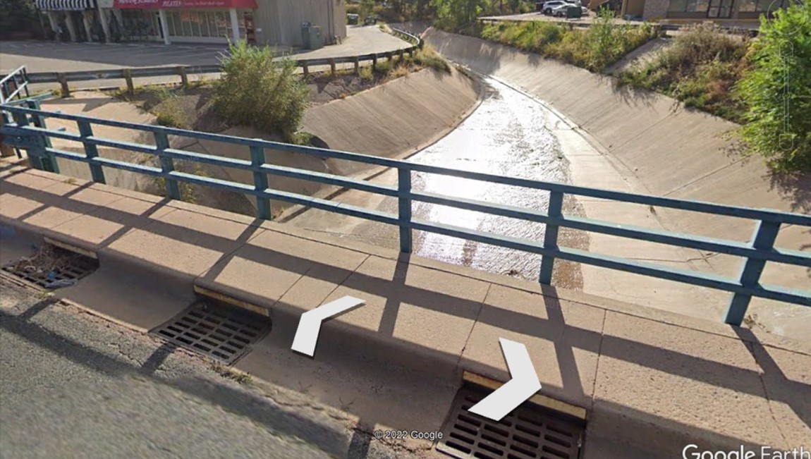
I tried to map the water management in the very neighborhood affected by fires, and I have to admit I’m entirely frustrated! All rainfall is diverted and disposed of as an inconvenience! Even the New Year’s snowfall that had fallen the day after the fires will eventually drain to canals. How can stormwater management allow for such drainage in the region, recording only 350 mm annual precipitation?
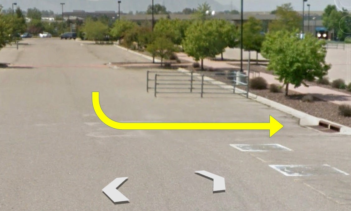
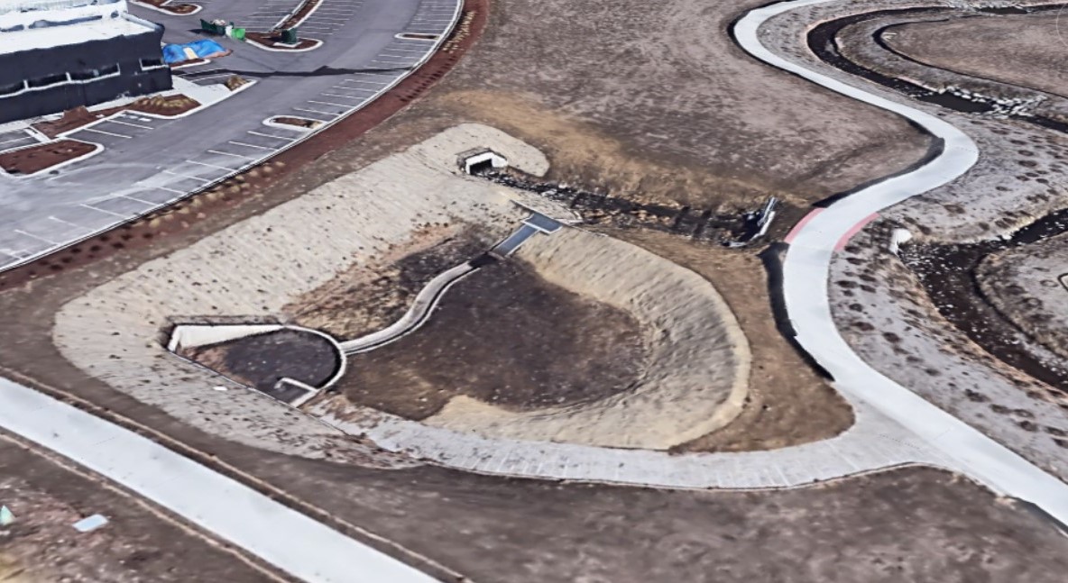
Without ever setting foot in the town of Superior, I can see the city may experience torrential rains at times as their urban solutions confirm the old water management: the rainwater runoff is collected from the sealed surfaces and drained into canals. I notice the new stormwater management components near some urban structures, mainly next to the shopping centers and public buildings. However, it seems their primary function is to provide for the runoff easement at times of downpours.
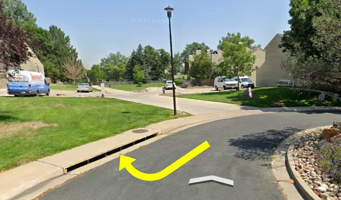
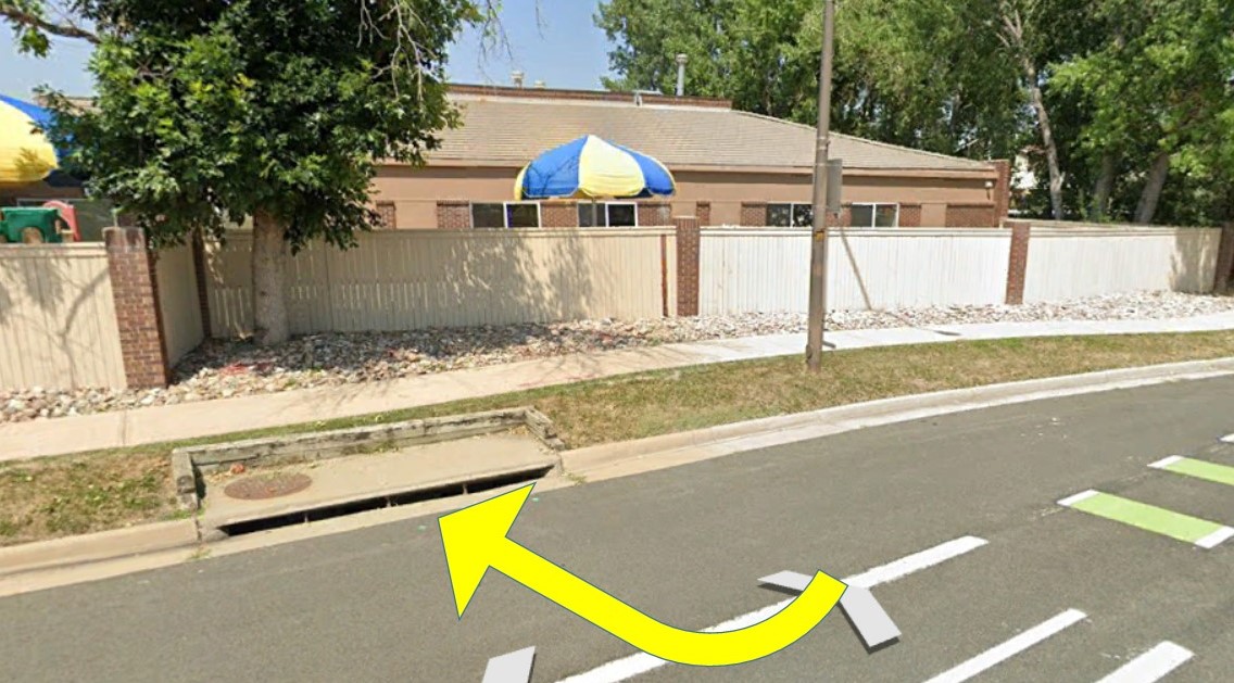
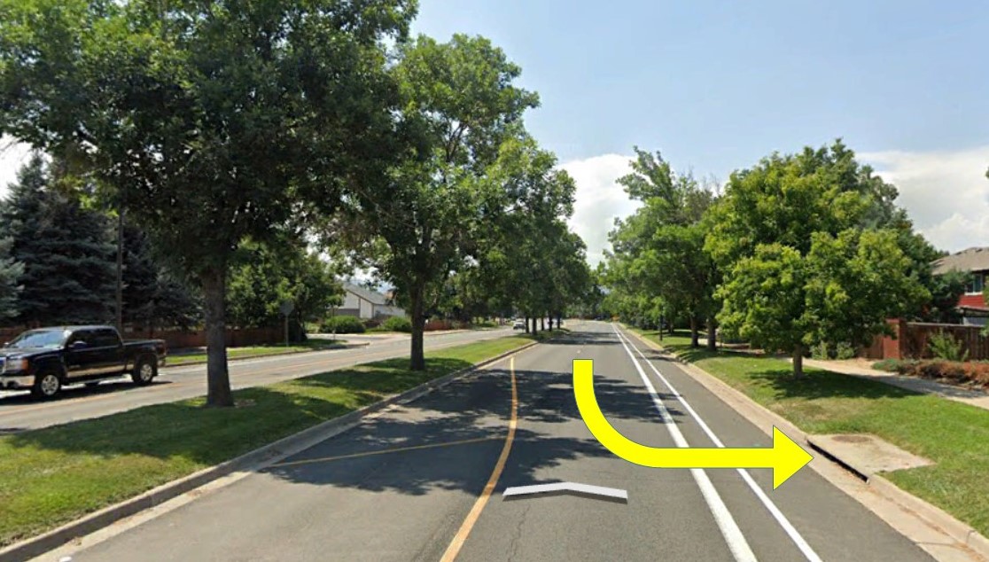
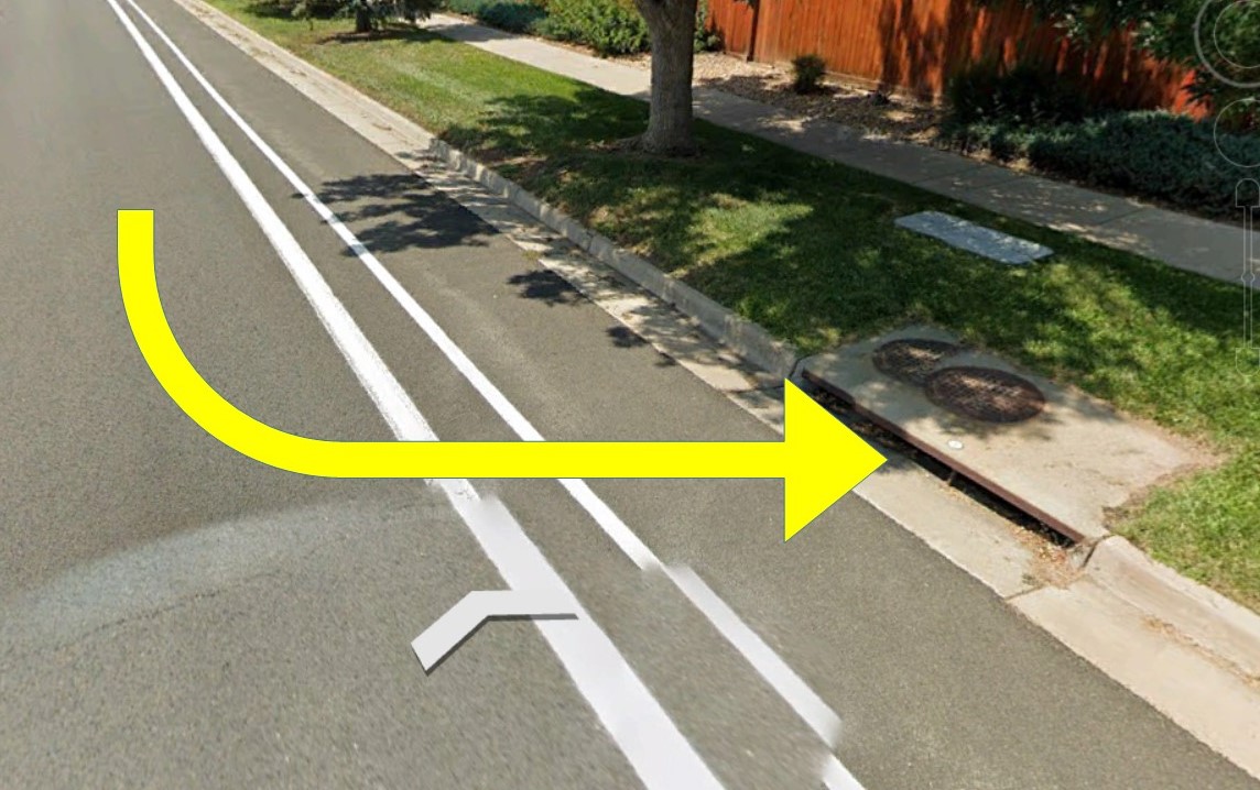
The old urban water management provides these ineffective solutions for the road infrastructures, parking spaces, and roof drainage of all the buildings.

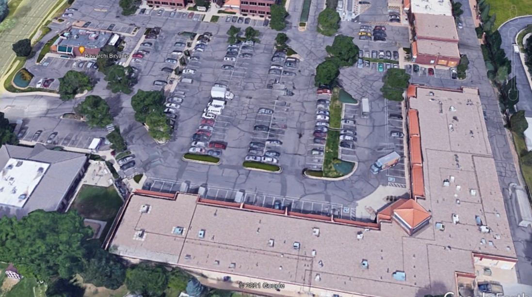
The long-term droughts and parched landscape lack moisture. The town demonstrate the need to water the public green spaces and gardens.
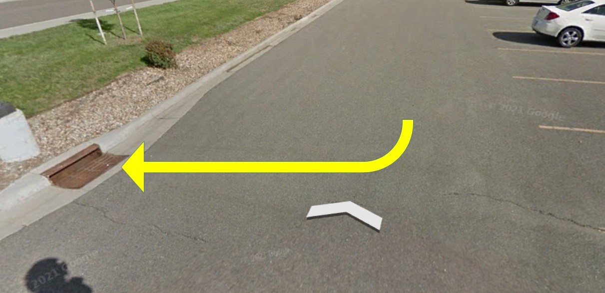
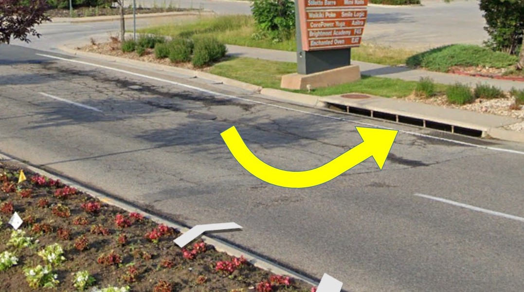
The overall town water management needs a new water paradigm shift. Pictures show examples of the old water paradigm, contributing to long-term droughts: the regulated creeks, fed by canals collecting the rainwater from the sealed surfaces.
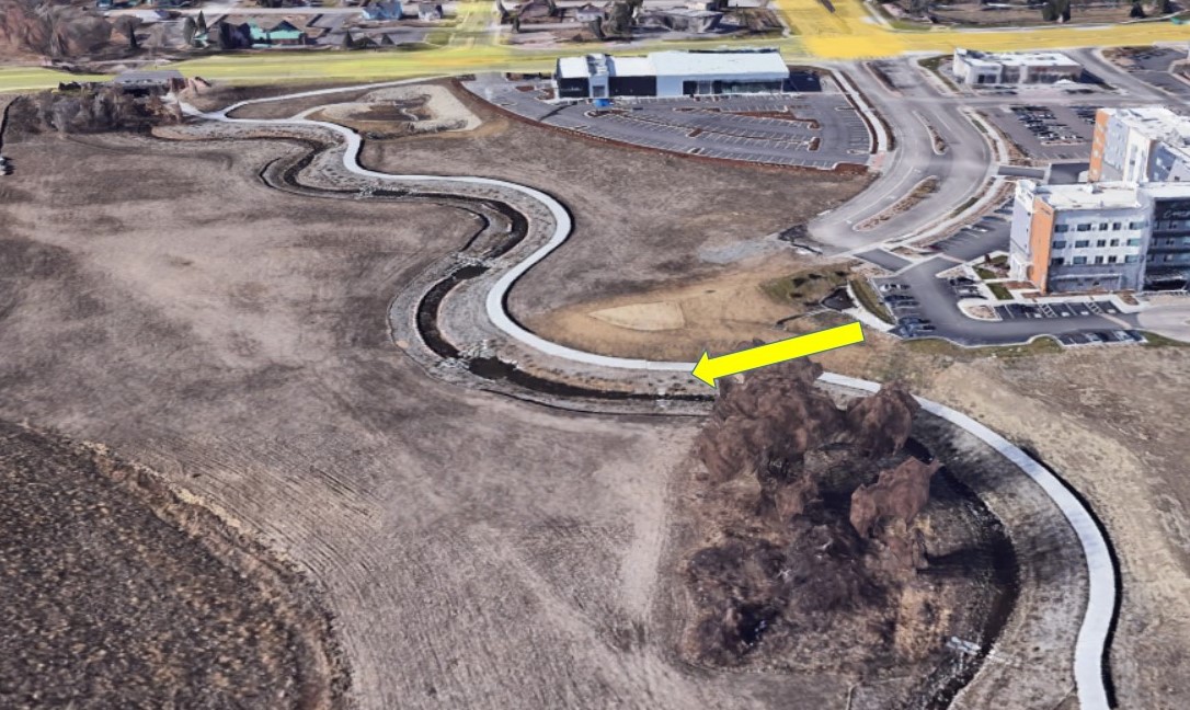
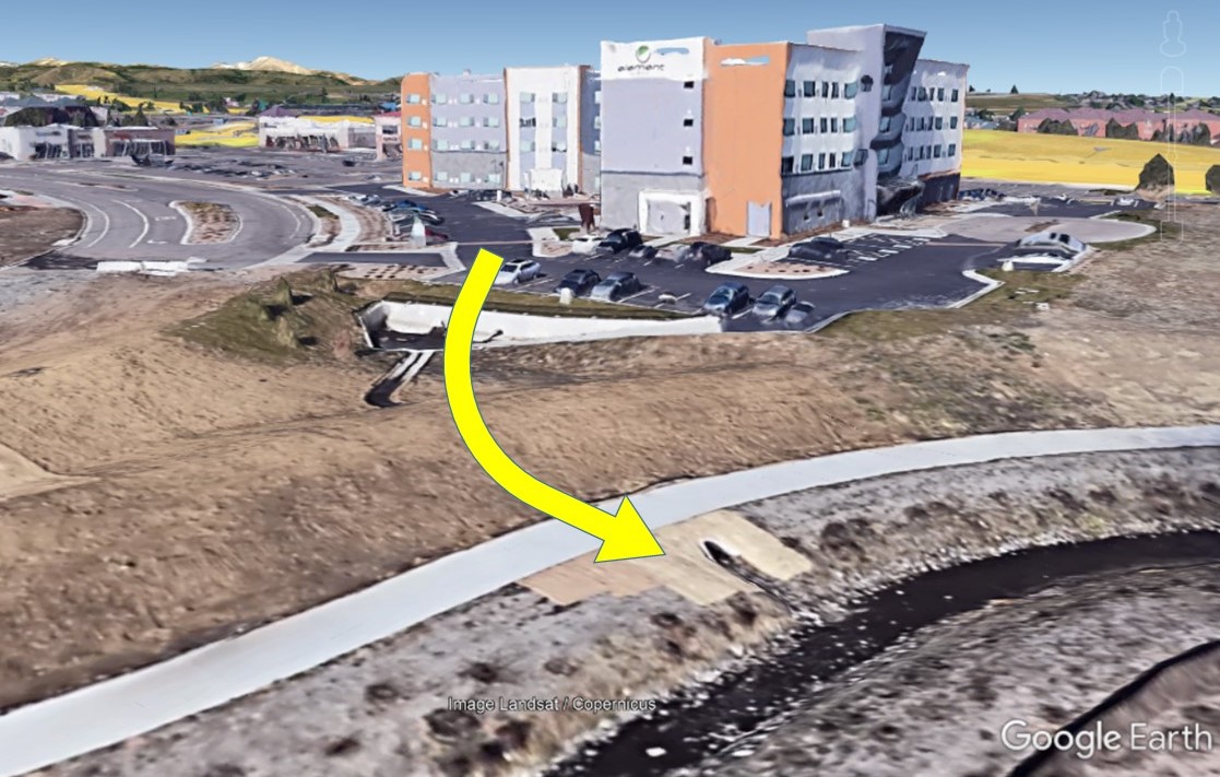
Most new sprawling towns and mountain resorts apply similar rainwater management in the Colorado Front Range Rocky Corridor, which cannot sustain sufficient greenery and nurture barely sparse vegetation due to a lack of rainwater in the whole region. Yes, this countryside depends primarily on the snowpack. Yet, there’s no excuse for discarding rainwater from spring to fall rather than encouraging the small water cycles.
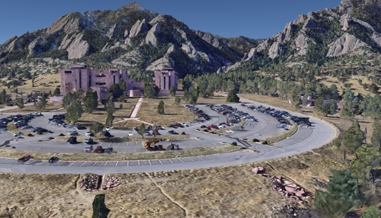
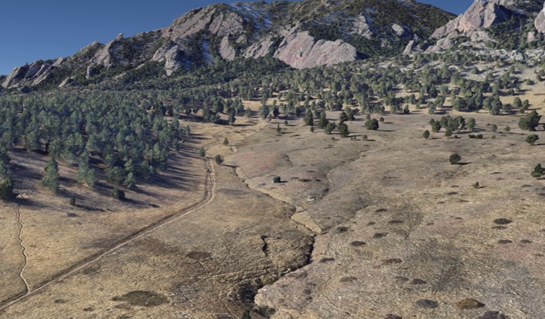
Let’s summarize the rainwater budget:
Urban territories with 5 million residents annually divert more than one hundred million cubic meters (100 mils. m3) of rainwater from an area of 5,000 km2 (2,000 square miles). That amounts to one billion cubic meters of rainwater without benefit in the last ten years. 1 billion m3 of rainwater could have been retained, slowed down, enriched soil and vegetation, or infiltrated slowly into the ground, recharging groundwater aquifers. 1 billion m3 of stormwater runoff drifted away in regulated canals, leaving an arid land and its habitats behind, including the surprised residents, lamenting the long-running water deficits.
Degradation of the watershed results in broken small water cycles. A loss of water from the soil and ecosystems has many outcomes, such as prolonged precipitation-free periods, with an overall long-term decrease in the precipitation balance. Next is the growth of extremes and their intensity over a shorter duration in time. Another effect impacts energy flows in the atmosphere and the overheating of the landscape. How does that manifest itself?
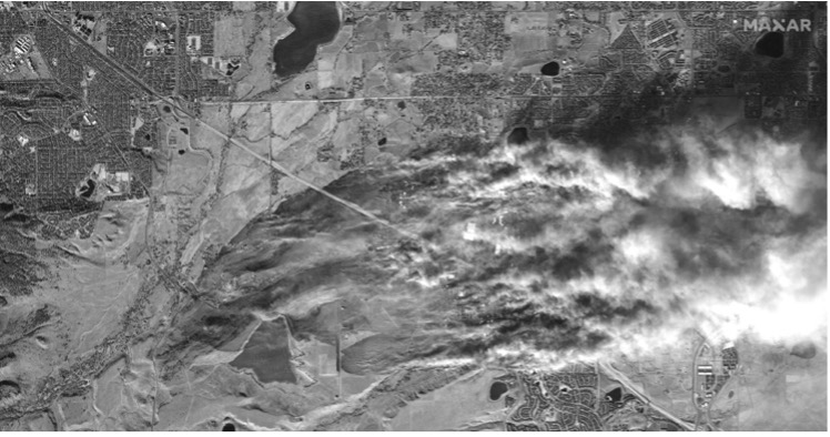
Strong wind gusts from 70 to 115 miles per hour caused damages in Boulder country, causing grass and utility fires, which spread fast to urban neighborhoods. This satellite image provided by Maxar Technologies shows an overview of South Boulder and the Marshall Fire burning Thursday, Dec. 30, 2021, near Superior and Louisville. (Satellite image ©2021 Maxar Technologies) https://www.dailycamera.com/2021/12/31/photo-gallery-satellite-imagery-of-marshall-fire-in-boulder-county.
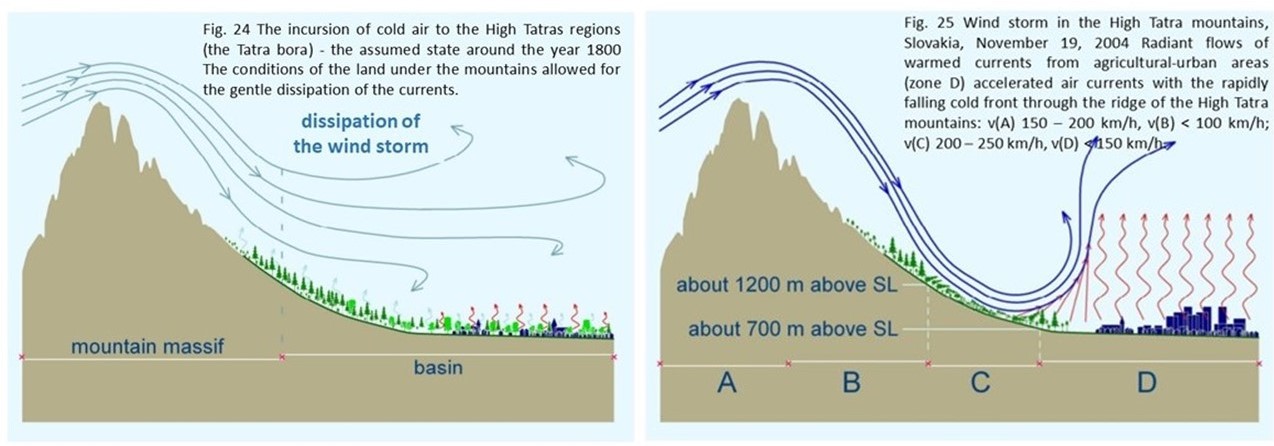
Source: A New Water Paradigm – water for the recovery of climate.
The first diagram depicts what difference the land alterations make. A landscape with sufficient soil moisture and a healthy watershed allows for heat and energy regulation and a temperate dissipation of the air currents.
The second diagram illustrates the contrary: a dry arid prairie or urban developments at the foothills of the mountain continue to maintain the warmer temperatures. There is nothing to hold back the wind as it crosses over the grasslands. It looks like the culprit is the sparse amount of vegetation and trees in the Great Plains. Nevertheless, the truth lies in the altered hydrology of the prairie and the whole watershed. The chinook winds always emerged on the Continental divide in the Rockies. But their strength and the occurrence amplified with the land alterations and land use. If there’s no moisture in the landscape to convert the solar energy, the heat dome renders a barrier. The uneven land temperatures accelerate within a narrower territory range and cause extreme wind gusts.
In addition to the decrease in water volume in small water cycles, which is reflected in the prolongation of the no-precipitation period, the overall long-term decrease in the balance of precipitation and the increase in extremes with a shorter duration also have impacts on atmospheric energy flows and overheating. How does it manifest itself?
With water scarcity in ecosystems and soil, the sun’s energy transformation and carbon binding to biomass production decrease as the intensity of photosynthesis decline. This reduces the evaporation of water into the atmosphere through vegetation. As natural water vapor diminishes, the sensible heat production in the troposphere increases because solar energy can not convert to water evaporation, resulting in droughts and overheating the environment: a regional climate change.
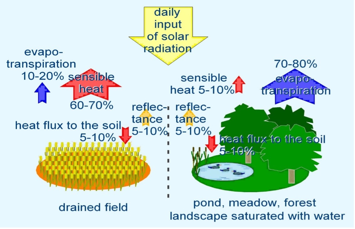
The urban environment with the most people (and sealed impervious surface, such as roads, parking lots, roofs) generates this sensible heat, producing thermal islands. Such is also the case in the Colorado Front Range Urban Corridor, where over 90% of the population resides. *The impermeable surfaces (drained field diagram) contributes to the thermal islands. Furthermore, unsuitable farming practices and golf-like lawns that do not allow rainwater to replenish the soil moisture and transform the solar radiation into latent heat act like a sealed cover. Prairies devoid of life cannot maintain the hydrological function of the watershed the way they used to. Water begets more water and life, just as biodiversity begets life. A few centuries ago, the prairies supported roaming bison herds, colonies of prairie dogs, and vast biodiversity habitats, including healthy soils with healthy mycorrhizal networks. Such ecosystem managed to hold water in the landscape. The rainwater retention and biodiversity were a conduit to a healthy watershed, recycling water through evaporation, transpiration cycles, and living creatures. Millions of beaver dams, prairie dog tunnels, and buffalo huff indentations helped to hold the water, recharge the water table and increase the soil absorbency by slowing the water down, sustaining the small water cycles, not droughts, and supporting more life. People can learn from the past. Urbanites and farmers can learn to retain the rainwater and invest in eco-restoration, which will help them fight droughts, fires, and floods. In the end, they would only benefit from a more healthy planet.
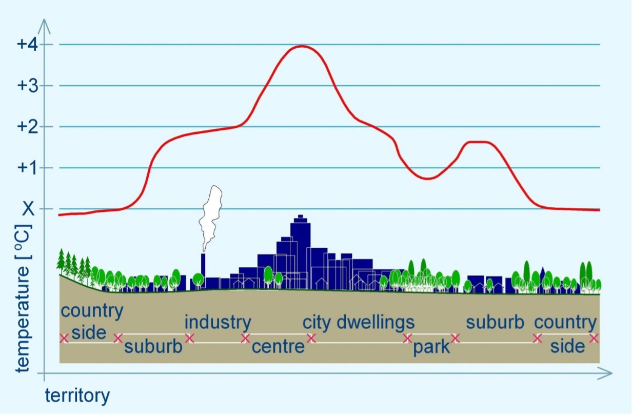
This heat island above the urbanized environment brings another phenomenon—a decrease in precipitation over damaged landscapes and an increase in precipitation in the mountains. Precipitation includes rainfall and horizontal precipitation, such as dew, etc., as we defined in small water cycles.
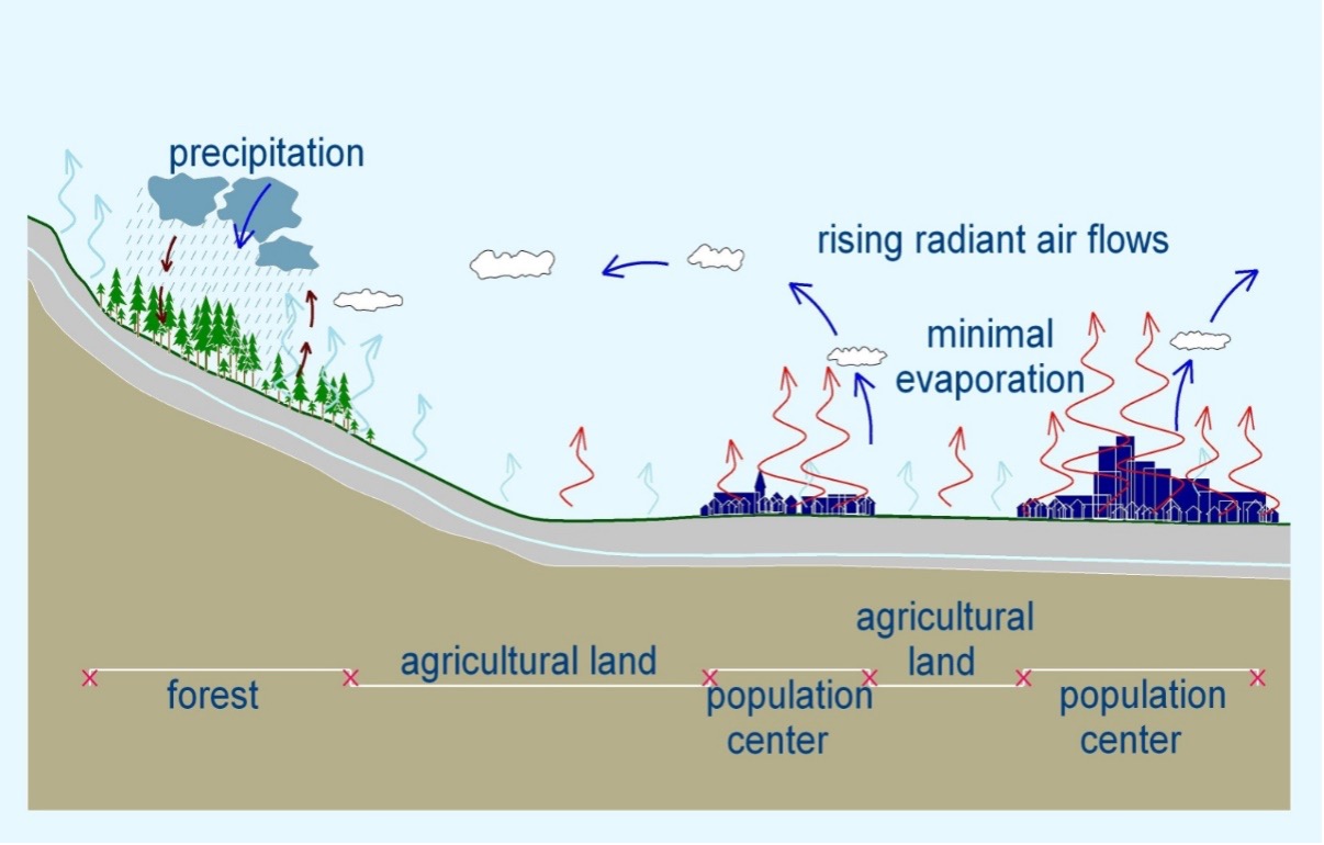
We know that the loss of natural water vapor by 1 m3 increases sensible heat production into an atmosphere by 700 KWh. By causing annual losses of more than 100 million m3 from the territory without the possibility of evaporation, 70 Terawatt-hours are released into the atmosphere annually. The entire Colorado economy does not consume this much energy in 4 years! This amount of energy affects the regional climate. The long-term droughts cause the entire area bordering the Rocky Mountains to overheat, which result in higher temperatures and lower evaporation.
Due to improper rainwater management, we estimate that summer temperatures have risen by more than 3 degrees Celsius.
The heat domes cause higher temperature differences between the Rocky Mountains and the urbanized part of the plateau. We already know the result. The more extreme wind ensues, which may cause the toppled powerlines or grass fires in the parched country.
Suppose the change in water management on the principle of ecosystem rainwater retention does not change in the near future. In that case, the entire area under the Rocky Mountains will fall into the trajectory of decline, as is currently the case with California. Colorado will face growing extreme weather events and the final transformation of the territory into a desert.
Land alterations modify the hydrological regime of the watersheds and depress the small water cycles, limiting evaporation and lowering the water table. A new water paradigm shift is needed to restore the ecosystems, including human habitats. I repeat my recent statement:
Drying the landscapes and ecosystems is humanity’s most significant crime. The Colorado fires were not caused merely by global climate change but by land alterations to the local watershed, resulting in regional climate changes and drying up of a landscape at the foothills of the Rocky Mountains.
One can comprehend that fluid loss in human health, and water imbalance in all ecosystems are similar. They have consequences for our planet’s health. The local climate conditions can be improved in Denver and any place globally. Integrated water and land management offer simple and successful solutions, but competent people, experts, and politicians must call for action and provide people with hope. So much is at stake! While we wait for new alternative energy technologies and carbon dioxide levels to decrease and use them as an excuse to continue degrading our land, we directly enable more damages to our farms and neighborhoods. Colorado urban fires were not an Act of God. They result from ecosystem degradation. Therefore, local and state governments must advocate for integrated ecosystem and watershed restoration, and stop drying the landscapes. Rainwater is a gift.
Author: hydrologist Ing. Michal Kravčík, CSc., Goldman Environmental Award Recipient
Contributing author: Ing. RNDr. Jan Pokorný, CSc.
Edit and translation: Ing. Zuzka Mulkerin
Photos: Google Earth. Diagrams: Michal Kravčík. A New Water Paradigm – water for the recovery of climate.
