WATER AND CARBON RESTORATION ACTION PLAN FOR UKRAINE

Working draft proposal for discussion and comments.

Author: Michal Kravčík, Ukrainian-born Slovak water manager and hydrologist

Edit and Translation: Zuzka Mulkerin

May 2022

RESTORATION

The UN Decade on Ecosystem Restoration seeks to stop and reverse the degradation of ecosystems and raise awareness of the importance of river basins and soil restoration, adding to the UN resolutions on Biodiversity and Water for Sustainable Development Decade. All state departments, municipalities, NGOs, and businesses are called to collaborate in their restoration efforts as one of the strategic pathways for achieving these resolution objectives.

WETLANDS

In support of implementing the UN Decades on Ecosystem Restoration, a best practice working group has been set up, led under the auspices of the Food and Agriculture Organization of the United Nations (FAO). FAO repeatedly calls for increased efforts to restore and revitalize the landscape and forests.

Among other things, this group stressed the importance of wetlands in revitalizing the landscape. Wetlands include areas of land saturated or flooded with water either permanently or seasonally and include peatlands, bogs, ponds, lakes, marshlands, swamps, peatlands, swamp forests, marshy meadows, and floodplains. Wetlands store twice the amount of carbon compared to forests.

LAND USE, LAND COVER ALTERATIONS – REVERSAL OF LANDSCAPES DRYING OUT

Unfortunately, globally, people have dried up more than 35 percent of land compared to 1970. These soil areas have promoted biodiversity and now lost the ecosystem function they once provided. The pursuit of complex and integrated solutions is a way that can bring about systemic changes in the use, protection, and restoration of natural resources as well as climate security. Integrated water and land-use management will increase the country’s water supply, which will improve the soil and ecosystem function. Rehabilitation of water storage is a key to restoring degraded soil, mitigating the risks of floods and droughts, and enhancing crop productivity.

3 PILLARS: WATER – ENERGY – FOOD NEXUS

With a global restoration of damaged regions and ecosystems, we will be successful if we systematically apply three fundamental pillars in managing natural resources. These are WATER, ENERGY, and FOOD. The connection between water (W) – energy (E) – food (F) draws well-known attention at the international level.

The fundamental elements on which each community and country exist are water, soil, and energy. With these resources in ample supply, humankind could survive even in the worst of times. Worsening of natural resources: loss of soil fertility, extreme weather events, and deteriorating environmental security are risks that are a challenge to address but also are pushing our coping mechanisms to the limit. For this reason, this action plan is geared toward comprehensive and integrated management of natural resources, which can systemically restore the results of wrong decisions in the past. We will be successful if we can methodically restore three fundamental pillars in managing native resources:

WATER, ENERGY, and FOOD.

The nexus between water (W) – energy (E) – food (F) attracts much attention from economists and researchers worldwide as a challenge to address related economic growth problems. In 2011, the World Economic Forum published a report titled ”Water- Security: The Water-Food-Energy-Climate Nexus,” which stresses that an integrated approach to water, energy, and food can increase resource security, efficiency, poverty reduction, and better resource management in all sectors. To achieve a sustainable water-energy-food (WEF) nexus, all human, and social scientists and businesses must combine their efforts in solving problems.

CONNECTING THE DOTS IN UKRAINE

To achieve the sustainability of nexus water-energy-food (WEF), all natural science institutes and social and economically oriented scientists must combine their efforts to solve problems and approaches for integrated policies. It is also essential to transforming research results into practice and real life. Wartorn Ukraine raises this subject. In Ukraine, too, the challenge is to connect the links between water, energy, and food and between weather, climate change, and biodiversity.

Comprehensive solutions to the WEF approach need to be sought, as climate change concerns water abundance, soil fertility, extreme heat, and the growth of natural disasters. One more important link arises from all the above conclusions and recommendations: It is necessary to help define and advance water, energy, and food solutions at any public policy level to make these commodities available in times of peace and crisis. Linking sectoral public policies to water, energy, and food also opens up space for the climate and socio-economic solutions to rebuilding war-torn Ukraine.

The deterioration of natural resources: loss of soil fertility, extreme weather events, and deterioration of environmental safety are risks that are a challenge to deal with but also an opportunity to manage these issues. With enough WEF resources, humanity can survive even in the worst of times. Water, energy, and food are the building blocks to rebuilding the country’s economy.

OLD WATER PARADIGM NEGATIVELY ALTERS LOCAL HYDROLOGY, WEATHER PATTERNS AND WATERSHEDS. REBUILDING UKRAINE CAN REVERSE THIS TRENDS.

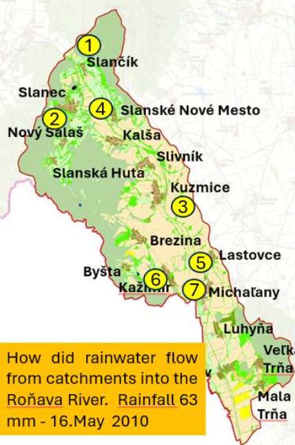
Since the second half of the last century, most countries in the world have based their rapid post-industrial economic boom on the unfortunate old water paradigm, where rainwater is an inconvenience that needs to be rid of as quickly as possible. Most of us urbanites spend 90% of our time in the metropolitan zones, where we want a nice and dry environment to make our lives easier. For decades, modern urban planning architects have designed new metropolitan developments for drainage and sent the rainwater down the drain to sewage and out to the waterways. We dried out our environment and our ecosystems.

Therefore, there is a permanent loss of water from small water cycles, with less water involved in photosynthesis, resulting in less carbon storage in vegetation and soil. If less water participates in thermoregulation and precipitation formation, there is a natural outcome – small water cycle degradation.

Loss of natural rainwater capture in the ecosystems and urban environment reduces the biorhythm of life in Ukraine, and its neighboring country, Slovakia. The absence of water in the landscape causes it to overheat and changes the temperature regime of the country. This causes a time and spatial change in precipitation distribution. Impervious urban surfaces and agriculture based on drainages change the hydrological cycles. Less water in the soil means less evaporation and transpiration through stomata of leaves and vegetation and less groundwater recharge. All restoration efforts need to pay attention to the water budget to rebuild the country and its economy.

If rebuilding the war-torn country, the territorial development plan cannot continue to be implemented on the principles of the old water paradigm. In urban planning, the currently used and “modern” water management is designed for drainage and offers no viable alternatives.

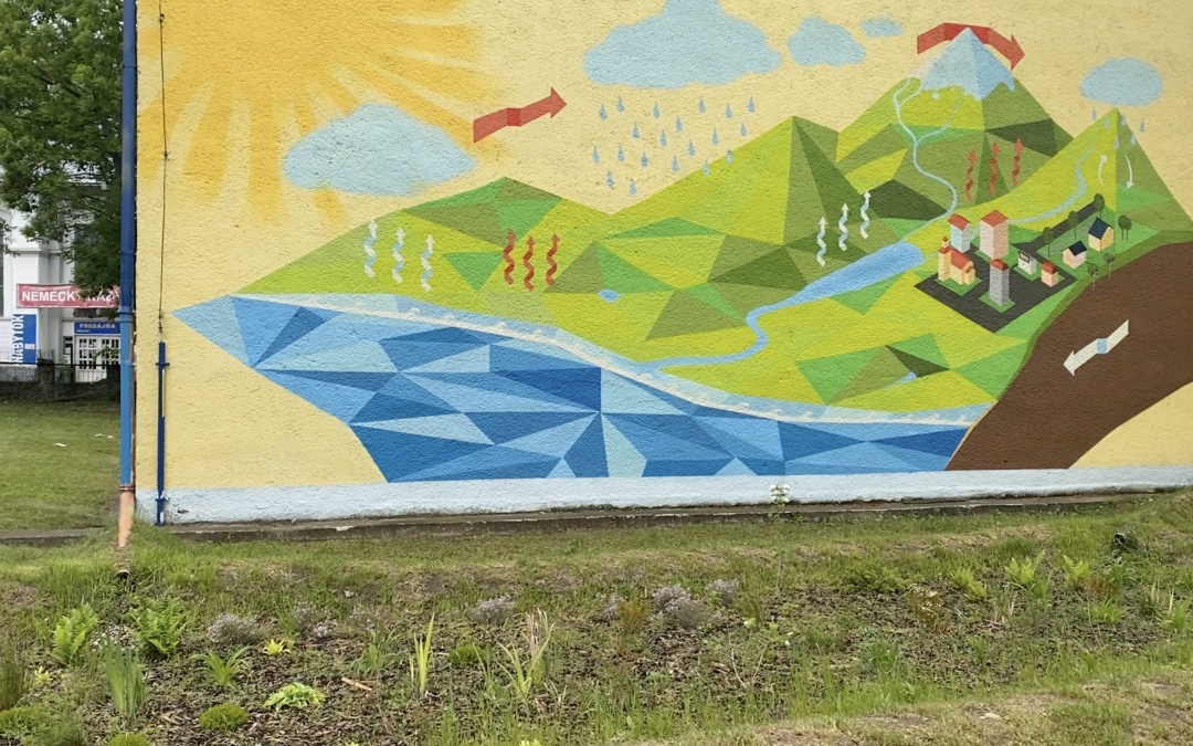
NEW WATER PARADIGM. SMALL WATER CYCLES AND LOCAL RAINWATER ARE PRECIOUS AND IRREPLACEABLE NATURAL RESOURCE

Currently, Ukraine drains more than 2 billion cubic meters of rainwater from its urban territories alone. Canal and sewage infrastructure depletes the biosphere of two billion cubic meters of stormwater and saps the vital resource out to the nearest waterways. This old urban management signifies a lost opportunity to sequester 4 million tons of CO2 each year. Suppose the reconstruction of war-torn Ukraine were to follow the old water paradigm. In that case, the ecosystems lose annually more than 2 billion m3 of rainwater as a precious resource, and 4 million tonnes of CO2 contribute to the annual growth of the carbon footprint. By 2050, Ukraine would contribute more than 1.2 billion tonnes of CO2 to global CO2 production, even if Ukraine’s entire industry switched to a green economy. That’s one fact. The second sober fact is that more than 1500 TWh of heat would be released into the atmosphere each year from the drying out of Ukraine’s rebuilt urban areas. Traditional last-century technologies in urban land use are outdated and will continue to contribute to the rise in the temperatures over Ukraine. Urban Heat Islands and Urban Dry Islands are not a way to go.

FERTILE SOILS – WORLD NATURAL AND CLIMATE HERITAGE

For this reason, the challenge for Ukraine is to have a post-war Recovery Plan for its war-torn homeland. After the war, Ukraine can start comprehensively integrating the WEF nexus principles and rebuild its country in line with respecting the ecosystem functions of rainwater as an irreplaceable resource. The New Water Paradigm demands that rainwater is the essence of life and must be left in the landscape where it falls. This also supports international efforts to address economic development and social and environmental security and significantly rehabilitate the climate. Ukraine is one of the rarest and most fertile territories in the world, known for its black and fertile soils, which should be ranked as a world natural and climate heritage site that, even at the time of the harshest dictatorial regimes not been destroyed. Just as the Earth’s Biosphere benefits from the Amazon rainforest, so do many countries in the world benefit from Ukraine’s breadbasket.

WOLD WATER AND SOIL BANK

However, this water and carbon bank is under the human anthropogenic influence, causing alterations to the water cycle, thus increasing the extremes in the weather patterns. These anthropogenic changes affect the ecological functions and threaten the biorhythm of the world’s water and carbon banks existing in the Ukraine territory.

Current grave and inexcusable war aggression pose a challenge for Ukraine and the world to protect further and sustain the Ukrainian soil in the ongoing climate change by parameters that can sustainably influence the WORLD WATER AND CARBON BANK existing on Ukrainian territory.

The world-class Ukrainian bank of water and carbon can bring prosperity and climate security to its free and proud citizens. At the same time, it can inspire the world on how to transform the state economy and bring positive examples while ensuring climate safety.

We need to realize that the current civilizations of the world are on the same boat on the raging seas while braving the globally occurring weather extremes. We need to seek, discuss, and bring about solutions that will advance the emancipation of the peoples of a world and pursue harmony, tolerance, solidarity, mutual assistance, and respect. We all have heard about a mirage. People in dried bubbles lose a realistic view of life and are under the illusion of being lost human beings in the desert without water.

PEOPLE AND WATER

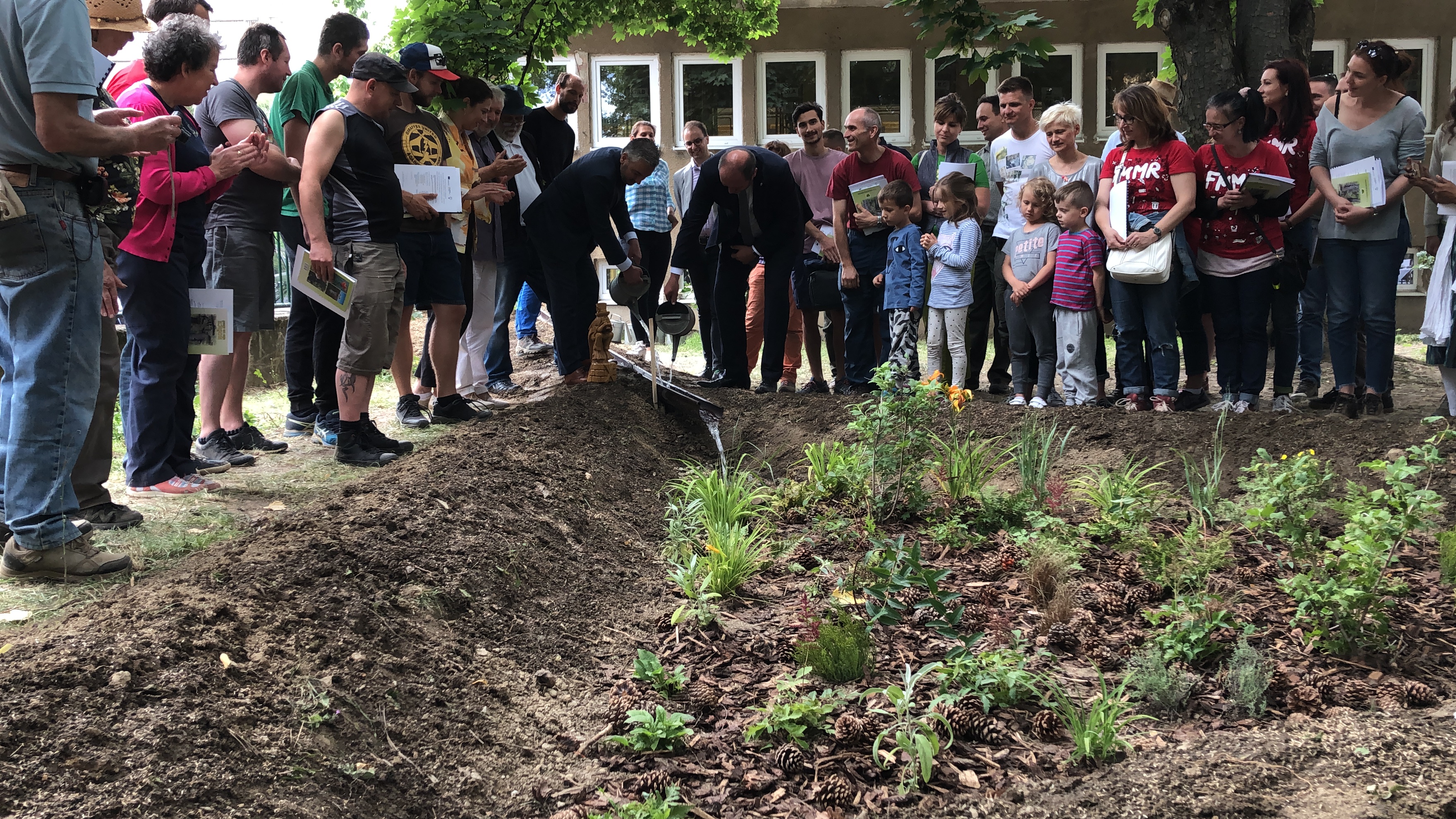
The world needs new models of economic growth, in which a glass of water will be neither half empty nor half full but always full. Such a climate recovery model is attempted by the group People and Water association and NGO and supported at the local and regional levels in Slovakia. Ongoing local and regional restoration of the damaged landscape points to the economic development path that benefits climate recovery. This knowledge arose from more than 30 years of research on hydrological andclimate processes in Slovakia. Using our experience, we now want to help rebuild war-torn Ukraine in the following steps:

1. To prepare a working version of the Climate Recovery Plan for war-torn Ukraine and raise funds from donors and supporters to cover the costs of preparing Ukraine’s climate recovery plan (June- July 2022)

2. Create a working team (about ten experts) for the processing of the Climate Recovery Plan for war-torn Ukraine (June-August 2022)

3. Establish the Institute for Climate Recovery of war-torn Ukraine, which will build the capacity for the implementation of the Plan (September-December 2022)

4. Develop a Climate Recovery Plan for war-torn Ukraine with clearly quantified benefits of climate protection, soil fertility, security, development of the local economy through legislative changes, competence in the reform of territory management, and reconstruction of war-torn settlements (June-December 2022)

5. Presentation of the World Water and Carbon Bank Recovery Plan in Ukraine (International Conference, Košice, Uzhhorod, January-February 2023)

6. Campaign to win supporters and donors for the World Water and Carbon Bank Recovery Plan in Ukraine

7. Implementation of the first model solutions after the war.

Košice, 27 May 2022, Michal Kravčík, Chairman of NGOs People and Water, Goldman

Environmental Award Winner

Ronava revitalisation

Ronava revitalisation

1. Introduction

The Roňava river basin is located in the southeastern part of Slovakia. As it is a relatively small basin, it is vulnerable to various types of weather. The basin is particularly prone to flash floods, which pose a serious problem and threat to the communities living in this area. The various types of flooding that occur lead to risks that have not been addressed for a long time. Due to its compact size and the way its forest-agricultural landscape is used for economic purposes, the river basin is not resilient to climate change. The region also faces increased heat waves, which further intensify the need for systemic changes in land management to effectively prevent gradual degradation and the growth of socio-economic problems in the long term.

Challenges facing the region

Previous activities in the Roňava river basin, focused primarily on draining large volumes of water from the basin, were carried out with the aim of creating favourable conditions for very intensive crop production through industrial agriculture. However, this approach has led to a reduction in the climate resilience of the landscape to extreme weather events. The urgent need to increase resilience to climate change requires finding and offering solutions that prioritise slowing down rainwater runoff and strengthening the natural productive potential of the area so that the landscape can cope with adverse weather conditions and periods of drought.

2. Analysis of the current situation

The Roňava river basin, covering an area of 212 km2 on the Slovak side, faces several long-standing serious environmental, climatic and, as a result, socio-economic problems. The more frequent occurrence of anomalous weather events in historical records confirms that, since 1980, there has been a trend of rising temperatures, with warm winters and hot summers marked by infrequent storm rains of low intensity, interrupted by episodes of intense rainfall.

There are 16 municipalities scattered across the Roňava river basin, covering an area of 192.82 km2 with the remaining 9% of the basin area belonging to neighbouring cadastral areas, also dominated by agricultural land. The analyses we prepared in this area were based on the needs of individual administrative units, enabling public institutions to use the acquired knowledge in their decision-making during spatial planning.

The current use of forest-agricultural and urbanized land increases the risk of frequent flooding. Rainwater runoff through forest transport infrastructure, the management of industrialized agricultural land, supported by the drainage ditches and canalization of all roofed and paved areas, has caused very rapid rainwater runoff into the river system with very frequent flooding.

Frequent flood threats are alternated with drought. The main cause of this unfavourable situation is the rapid runoff of water from drainage areas. The water then quickly accumulates in the river system, causing flooding and, at the same time, preventing the necessary infiltration of this rainwater into the soil.

There are 16 communities in the Roňava river basin, where we mapped the landscape structure and the extent of its degradation. The results are shown in the following figure, along with the location of the municipalities. The basin is dominated by intensively cultivated agricultural land (35%), which, together with permanent grassland, accounts for more than 50% of the basin’s total area. Forest ecosystems make up almost 20% of the landscape structure of the river basin, which is approximately half the percentage of forests in the whole of Slovakia.

The lower part of the river basin has favourable conditions for growing fruit and grapes. There are more than 450 hectares of vineyards and almost 850 hectares of orchards and gardens. The drying of the landscape is also influenced by reduced infiltration of rainwater into the soil profile, which also contributes to an increase in temperature. The increased temperature causes an increase in potential evaporation from the landscape. As evaporation increases, we observe that, according to SHMÚ sources, groundwater levels have declined in all monitored locations.

The long-term trend of rising temperatures is significant both in the mountainous forested part of the river basin and in the lowland part. In more forested areas, average annual temperatures have risen (in Slanec) by +2.7 °C. In more open agricultural landscapes, average temperatures have risen by 2.9 °C.

This suggests that the decline in groundwater levels in the lower part of the river basin is probably even greater, as historically, the temperature increases are higher in agricultural and urbanized areas (see comparison of Slanec and Malá Tŕňa).

It is also very important to understand temperature anomalies throughout the year in order to recognise their relations with the agricultural industry, which is dominant here. Cultivated crops are sensitive to the temperature regime of the landscape, and in order for them to withstand dramatic weather changes (such as frequent spring frosts), it is necessary to strengthen the landscape’s resilience against drying. Longer periods without frost in winter affect the early onset of vegetation, which is then threatened by subsequent spring frosts. See the development of temperature anomalies, especially in winter and with the onset of spring, in the lower part of the river basin in the following diagram.

These negative phenomena are also caused by the drying and overheating of the landscape, with the subsequent frequent occurrence of late-night frosts in the area, which causes significant damage to fruit growing in the region. Strategically, these risks can be prevented if more water remains in the landscape structures to slow down the processes of cooling and heating of the landscape. Framework analyses indicate that it is necessary to strengthen water retention based on the ecosystem principles in any form of farming and land use. In agricultural land, it is essential to implement Nature-based Solutions (NbS) that will act as air conditioning units in the landscape. This fact is also confirmed by the thermal images shown, which show that on 1 May, the temperature of the dry earth surface already exceeds 40 °C.

In agricultural landscapes, it is necessary to support soil water reserves across the board. The priority is to enhance the replenishment of water resources in landscape structures, with permanent availability of sufficient water to sustain the growth of vegetation of any kind. We need to air-condition/cool the landscape environment by evaporating water from vegetation.

Each cubic meter (1,000 litres) of rainwater that remains in the landscape contributes approximately 300 litres to the replenishment of groundwater reserves. The remaining 700 litres of water evaporates and solar energy is consumed for its evaporation, which removes approximately 500 kWh of heat from the environment. This improves conditions for vegetation growth and contributes to increasing the landscape’s resilience to climate change. Water evaporated from the landscape returns to the small water cycle and can form dew, which is much-needed and useful free water that contributes to vegetation growth. Areas where more rainwater is captured can increase horizontal precipitation (dew) by more than 50 litres per square meter of soil.

Economic use of the landscape in the recent past (1970-1990) promoted widespread drainage and subsequent drying of the landscape. This contributed to faster drying of agricultural land and subsequent overheating of the surrounding environment, and thus to a decrease in precipitation. As mentioned above, rainwater from degraded and man-made parts of the landscape drains away quickly, which also contributes to the drying of the landscape and its subsequent overheating.

In open agricultural landscapes, there has been a significant decline in annual precipitation balances because the landscape is drier, heats up rapidly, and creates higher pressure over dry areas. Under such conditions, clouds and subsequent rainfall form less frequently over these parts of the landscape.This is confirmed by trend analyses of annual precipitation totals. In the open countryside, the decline has reached approximately 8% over the last 50 years. In even more exposed agricultural areas with intensive farming activity, the decline in annual precipitation exceeds 12%.

The following findings emerge from the presented integrated framework analysis in the Roňava river basin:

1. Less frequent rainfall alternating with intense downpours and rapid runoff from intensively used land.

2. Landscape drying, declining groundwater levels, and loss of soil fertility.

3. Overheating of the land, increased sensible heat flux into the atmosphere, and rising ambient temperatures due to insufficient moisture.

4. The Roňava river has effectively become a canal that collects rainwater and drains it into the Bodrog, Tisa, and Danube river systems, thereby losing its function as a stable water ecosystem.

If no measures are taken, the Roňava river basin faces the following future threats:

1. More frequent dry and hot summers, alternating with extremely intense rainfall

2. Increased flood damage, demographic decline

3. Threat to the remaining biodiversity

4. Higher costs for agricultural production and deterioration of the forest management. Climate change in the Roňava river basin manifests through negative effects such as reduced water availability, greater temperature extremes, alternating torrential floods and long periods of drought, and loss of soil fertility.

The most effective technology for monitoring temperature changes in the landscape is the use of thermal imaging cameras. Thermal imaging allows us to effectively identify the need for and positive impact of NbS (Nature-based Solutions) on the temperature regime of the landscape. Thermal imaging cameras are commonly used in construction. For example, when mapping heat loss from buildings.

This technology can also be used effectively to map the temperature regime of the earth’s surface/landscape/ecosystems and to quickly identify not only the current state of landscape drying, but it can also be used to design specific measures. Thermal imaging can also be used to understand the impact of changes in the temperature regime of the landscape, for example, through the implementation of NbS, helping us to understand the air conditioning effect.

In order to be able to use thermal imaging in the assessment of the climatic characteristics of ecosystems and their damage, we present three examples of conventional land use in its current state, and also three examples of the temperature ecosystem temperature regime after the implementation of Nature-based Solutions. These technologies can be effectively used to assess the real impact of implemented NbS on the temperature regime of the landscape and also to quantify the climatic characteristics.

We selected three characteristic ecosystems: agricultural land sown with soybean, a forest ecosystem with trees, and an urbanized, drained landscape with grass surfaces.

In agricultural landscapes, the ground surface beneath the crops is dry, so the temperature often exceeds 40 °C. The temperature of the leaves is 10 degrees lower. This temperature difference indicates that the ecosystem does not have enough water for evaporation and that the plants suffer from a lack of moisture, which limits their growth. We also chose this thermal image to highlight the sensitivity of the recordings and the calibration of the temperature regime. If the temperature difference between the ground surface and the plants were smaller, crops would have better conditions for achieving higher yields.

The temperature regime of forest trees clearly indicates drought, as the cooler parts of the ecosystem have tree trunks near the ground level. The upper parts of the tree trunks have a relatively high temperature, which confirms that the trees are suffering from a lack of water for their growth.

The thermal image was taken on 11 August, when the drought in Slovakia was at its peak after a previous long period without rain, which was also reflected in the dryness of the forests. Trees suffer from water deficit and therefore overheat quickly because they transpire less. This weakens photosynthesis in the forest ecosystem and has a negative impact on wood increments. It is also possible to observe a relatively high temperature difference between the lower parts of tree trunks and the tree crowns, reaching up to 5 °C. This confirms a significant moisture deficit in the soil with a negative impact on wood increments and the economic results of forest managers.

The third example of landscape temperature assessment comes from an urbanized city landscape.

Here, the temperature difference between the atmosphere and the hot road surface exceeds 35 degrees. The coolest areas within tree vegetation reach temperatures of more than 45 °C, which confirms that dry grass and trees have a weak cooling effect because they lack water and, in this state, cannot contribute sufficiently to improving the climate. Unfortunately, rainwater management in the area is solved by drainage. By changing rainwater management, by collecting it in grassy vegetation and in the root zone of trees and shrubs, the climate of the ecosystem would be improved, and the temperature could drop by up to 10 °C compared to the current situation. This example highlights the potential for using rainwater in spatial planning to increase the climate resilience of ecosystems.

The following three examples highlight the possibility of using thermal imaging to assess the impact of Nature-based Solutions (NBS). We selected three examples. A micro-pit in the terrain where rainwater is collected and seeps into the soil, a water surface in the forest, and implemented contour infiltration strips where rainwater is collected, and what impact these elements have on the thermoregulation of the landscape in both hot and cold weather.

The first image clearly shows how the rainwater collected in a micro-pit, dug by wild boars while foraging, causes cooling. The water retained and absorbed in the pit, which is about 0.3 m deep, creates a cooling effect. In the height of summer, the surface temperature of bare soil can reach up to 59 °C.

This example shows the importance of retaining every litre of rainwater to reduce surface overheating.

The second example is a thermal image of a small body of water taken on 12 September during cooler weather. In colder conditions, bodies of water warm the earth’s surface. This means that while the temperature in the surrounding vegetation dropped significantly to 9 °C, the body of water, which was heated during the summer, cools down more slowly in the autumn and helps balance temperature differences. This is a very important insight for landscape use proposals so that the landscape remains resilient in both hot and cold weather.

The third example of a thermal image from 11 July 2024 is from NbS implemented in a completely degraded site without vegetation. Thermal imaging shows that the restoration of degraded land through rainwater retention has regenerative effects and promotes not only the restoration of the degraded ecosystem by retaining rainwater through NbS, but also the air conditioning of the ecosystem through water evaporation from vegetation. We estimate that the temperature of the earth’s surface without vegetation at the peak of summer can exceed 60 °C. Because all rainwater at the site is collected, i.e., it does not run off the surface but evaporates after being retained on site, the temperature according to thermal imaging records reaches less than 35 °C.

The NbS implemented on a 3-hectare site reduces the temperature of the monitored surface by more than 25 degrees. Quantification of the impact of rainwater harvesting through NbS provides the much-needed knowledge of the impact of landscape structure on climate in the LAND4CLIMATE project in a specific implementation in the Roňava river basin. The timeline from the site confirms the rapid regeneration of the ecosystem when sufficient rainwater is retained in the landscape.

THE WINDOW OF OPPORTUNITY FOR CLIMATE CHANGE MITIGATION IS TIGHT.

THE WINDOW OF OPPORTUNITY FOR CLIMATE CHANGE MITIGATION IS TIGHT.

A narrow focus can have critical implications for strategic decision-making in tackling climate change, such as droughts or flooding.

Tons of paper have been written about the impact of increased carbon dioxide concentrations and other greenhouse gases in the atmosphere. Large amounts of money has been invested in trying to find solutions. We know that atmospheric CO2 levels have been rising in the atmosphere, especially since the 1960s. Mauna Loa’s graph clearly indicates the sharp rise in carbon dioxide in the second half of the last century due to advanced industrial human activities. Indeed, the increase in CO2 concentrations over 60 years has been unprecedented compared to the previous 10 thousand years! [Figure 1].

Figure 1: Carbon dioxide concentrations over the last 10,000 years.

NASA records show the rise of global temperatures over the same period [Figure 2]. A question arises whether the increase in CO2 concentration in the atmosphere and the soaring air temperature is precisely the correlation that would unequivocally confirm Earth’s overheating. A narrow focus on finding one answer in tackling climate change can be costly.

Figure 2. Data source: NASA’s Goddard Institute for Space Studies (GISS)

Let us look at another set of historical data over the last ten thousand years: the global and regional temperatures. Can we confirm that planet Earth’s temperatures remained relatively stable during the steady low carbon dioxide concentrations? This would most likely be confirmed if, during the last 10,000 years, the temperature in any corner of planet Earth remained stable while CO2 concentration in the atmosphere also did not change.  

The unanswered question, then, is whether research exists that would monitor changes in temperature, precipitation, or other climatic characteristics on planet Earth in the long term? 

We know fully well that systematic global climate monitoring dates to the second half of the 20th century. Do we have the historical data for the longer term? Some methods show it is possible to get to know the climate even in ancient times, which could precisely characterize the condition of the environment even a few decades ago. One such method is an analysis of pollen grains because pollen is an indicator of the quality of the ecosystems. This method was used by Australian scientist Simon Eduard Connors of the University of Melbourne. He summarized his research in Georgia in his scientific work A Promethean Legacy: Late Quaternary Vegetation History of Southern Georgia, Caucasus.

Research confirms that the temperature here has changed in time and space, yet precipitation pattern has also changed over the last 14 thousand years. In those areas of Georgia that have been more economically exploited, not only have temperatures risen, but rainfall has fallen. In inhospitable mountainous regions devoid of human activity, it is precisely the opposite: temperatures dropped, and precipitation rose. 

Those time and spatial changes arose long before the carbon dioxide concentration in the atmosphere began to grow. Similar time and spatial changes in precipitation distribution occurred in the 20th century in Slovakia because of land alterations. Wherever people settled and modified the land use, ecosystem transformations and drainage conversions often followed. That wouldn’t be the greatest sin if people allowed the rainwater to slowly infiltrate the ground and recharge the aquifers wherever they settled, instead of allowing it to run off. Modern people value convenient farming, nice and dry dwellings, and roads, often forgetting that impervious surfaces do not allow water to rehydrate and sustain their environmental conditions. People design for drainage and discard water away because they do not make a crucial connection: water that falls from the sky has everything to do with what happens on the ground or in the ground. Rainwater sustains all biodiversity and vegetation, nurtures the soil, and therefore crops, allowing plants to transpire and cool the air and surfaces. Not connecting the dots, humans transformed the gardens of Eden into deserts, generating heat domes over cities and degraded farming land. In the last 60 years since the increasing concentration of CO2 in the atmosphere, modern humans have converted, damaged, and dried up more than 20 million square kilometers of land, which has lost its fertility and turned into a barren desert. The land use alterations modify different watersheds and their hydrology and are directly related to the increased CO2 concentration in the atmosphere. CO2, like water and the Sun, is an essential part of life. When less carbon dioxide is absorbed in the growth of vegetation through photosynthesis due to water scarcity in ecosystems, it remains in the atmosphere. 

Due to a lack of water in secondary precipitation in small water cycles, plants break down less CO2 during photosynthesis, leaving more in the atmosphere. 

The New Water Paradigm. Water for the Recovery of Climate.

The fact that science does not pay sufficient attention to the disintegration of small water cycles has dangerous implications for strategic decision-making in tackling climate change. We solve partial problems and do not solve the core issues. Why? Well, simply because we maintain the old water paradigm, where rain is considered an inconvenience, we try to get rid of it as quickly as possible, allowing the avoidable runoff to needlessly evaporate or flow out to the nearest river and out to the sea. The history of Georgia’s old culture confirms this. The window of opportunity for climate change mitigation is tight. We need to talk about the importance of rainwater out loud and start urgently enforcing a very simple but essential principle:

WATER, GOD’S GIFT, IS NOT A WASTE, BUT THE ESSENCE OF LIFE AND OUR VERY EXISTENCE.


Author:  Michal Kravčík

Please refer to my book chapter: Projects Implemented and Lessons Learnt from the New Water Paradigm, to read more about the integrated water and land management. 

Translation and edit: Zuzka Mulkerin

Picture credits: Bee pollen photo by Myriams Fotos from Pexels. Window photo by Zuzka Mulkerin.